Automating Topographical Surveys
Stringer Topo simplifies survey workflows by converting raw data into CAD-ready models, automating breaklines, and enhancing surface modeling accuracy..

Stringer Topo simplifies survey workflows by converting raw data into CAD-ready models, automating breaklines, and enhancing surface modeling accuracy..

Stringer Connect automates the import, processing, and adjustment of raw field survey data from leading survey instruments. Convert raw observations into CAD-ready models, manage control points, and make real-time edits with a dedicated graphical survey editor. With instant integration into AutoCAD, Civil 3D, and BricsCAD, it ensures faster, more accurate survey workflows.

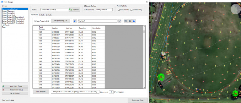
Stringer Topo enhances COGO point management across AutoCAD, BricsCAD, and Civil 3D. Easily import, edit, and categorize points with customized presentation, labeling, and grouping tools. Dynamically reference objects, perform transformations, and output data with a single click. Whether using Civil 3D or standalone CAD, Stringer Topo ensures precise, efficient, and flexible point management for your survey projects.

Stringer Topo simplifies survey linework and breakline management, letting you quickly add, edit, or remove survey strings directly in the drawing. With AI-assisted reordering, smart editing tools, and dynamic updates, surveyors can correct pickup errors in minutes instead of hours. Customize polyline outputs, fix intersections, and streamline workflows with intelligent automation for precise and efficient survey modeling.

Stringer Topo’s 3D Model Viewer provides a fully rendered, data-accurate visualization of your surveyed surface. Review COGO points, breaklines, and triangulated meshes in real time while making edits. Use click-button exaggeration to detect issues and verify survey accuracy. Enhance analysis by displaying surveyed points, strings, and 3D objects, ensuring a precise and optimized surface model.

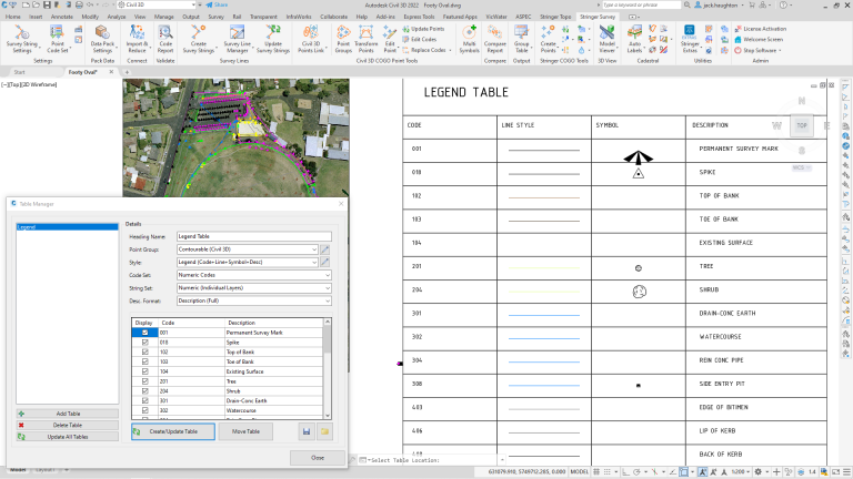
Stringer Topo enhances survey documentation with automated legend tables, multi-symbol support, and conformance reporting. Instantly generate customizable tables for points and survey strings, apply scaled tree symbols, and audit survey quality with built-in compliance checks. Output comparison reports in Excel, CSV, or drawing formats, while cadastral tools assist in precise linework adjustments, labeling, and radiation table creation.


